

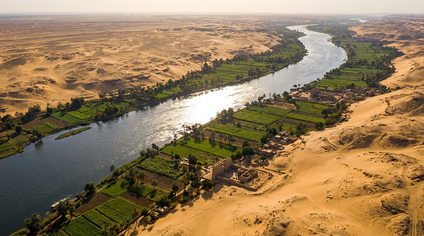
The map of ancient Egypt is really a map of one river. A narrow green ribbon follows the Nile through desert, then splits into a wide fan-shaped delta near the Mediterranean coast. The deserts, the cataracts, and the border with Nubia all existed to protect or feed that ribbon.
You cannot separate Egyptian civilization from that geography. The Nile’s flood cycle set the farming calendar, the cataracts blocked invaders and trade in equal measure, and the split between Upper and Lower Egypt shaped politics for millennia. Here is how the land actually worked.
The Nile flood cycle that made farming possible
Every year, rains over the Ethiopian highlands sent floodwater north into the Nile, which rose over its banks and spread across the valley floor, carrying silt that settled once the water receded.
That silt is why Egyptians called their land Kemet, the black land, distinct from the red desert on either side. Farmers planted directly into it once the flood dropped.
The Egyptian calendar tracked this cycle rather than familiar seasons. Akhet was flooding, Peret was planting and growth, Shemu was harvest before the next flood arrived. Miss that timing and the year’s food supply was at risk, part of why Egypt’s economy ran on grain rather than coins.
Why the cataracts controlled who could reach Egypt
South of Aswan, the smooth river turns into rocky, shallow stretches called cataracts, numbered as you travel upstream into what is now Sudan. Boats could not simply sail through them.
The first cataract, closest to Egypt proper, marked the traditional southern border for most of Egyptian history. It worked as a natural checkpoint on trade in gold, ivory, and people from Nubia.
Egyptian rulers built forts near these chokepoints because geography already did half the defensive work.
Upper and Lower Egypt: one river, two kingdoms
Egyptian geography runs opposite to what the names suggest. Upper Egypt sits in the south, upstream, where the land is narrow and hemmed in by cliffs. Lower Egypt is the north, downstream, where the Nile fans into the delta.
These began as two separate kingdoms, each with its own crown and patron deities. Tradition credits their unification to a ruler remembered as Narmer or Menes, who combined the White Crown of the south with the Red Crown of the north into one double crown.
Pharaohs kept calling themselves ruler of the Two Lands long after unification, a title that reflected real geographic tension, one that shows up in how power actually flowed through Egyptian society.
The deserts as walls nobody had to build
On a map of ancient Egypt, the deserts are not empty space. They are the border wall. The Western and Eastern Deserts flank the Nile valley on both sides, and crossing either one without knowing the route meant death from heat and thirst.
This barrier is a major reason Egyptian civilization saw less large-scale foreign invasion than Mesopotamia, which sat exposed on flatter, more open terrain between rival powers.
Those same deserts held resources worth the risk. Egyptians mined gold, copper, and building stone from desert quarries, using organization you can trace through Egyptian architecture beyond the pyramids.
Frequently asked questions
What did the map of ancient Egypt actually look like?
A narrow green valley following the Nile, widening into a triangular delta near the Mediterranean coast, flanked on both sides by desert. Upper Egypt lay south in the narrower valley, Lower Egypt north across the delta.
Why was Egypt divided into Upper and Lower Egypt?
The geography itself split the land into two zones with different landscapes and, originally, different rulers. The narrow southern valley and the wide northern delta developed as separate kingdoms before unification under one crown.
How did the Nile’s flooding shape ancient Egyptian life?
The annual flood deposited fertile silt across the valley, making farming possible in an otherwise dry region. Egyptians built their calendar and much of their economy around predicting and using that cycle.