

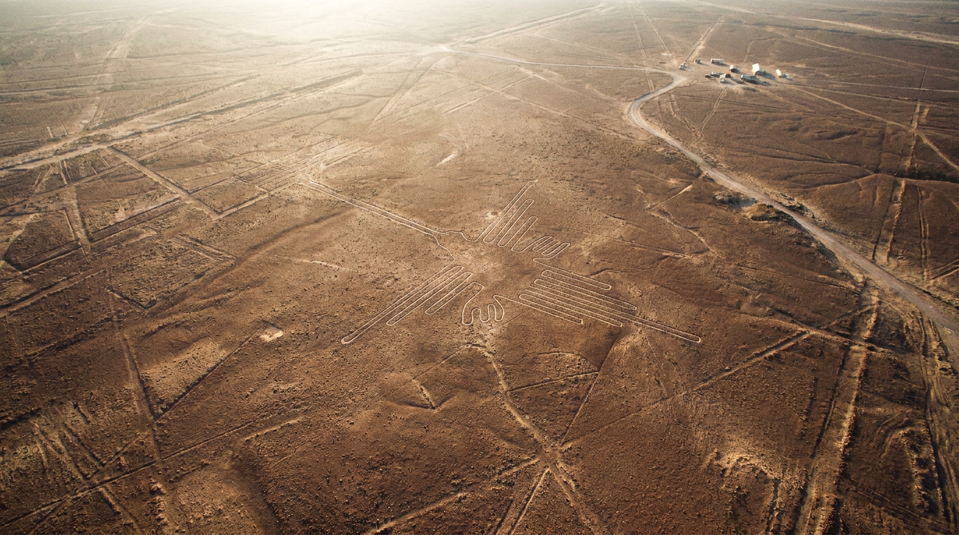
The Nazca lines purpose theory with the most ground support today combines water ritual with walking ceremonies, plus some seasonal timing. The pure “giant calendar” idea lost ground once archaeoastronomers judged the alignment evidence too weak to carry it. Recent foot surveys place the small figures on average 43 m from ancient footpaths.
The lines were scratched into the desert of southern Peru between 500 BC and AD 500, about 400 km south of Lima, across roughly 450 square kilometres, according to UNESCO. Builders removed reddish-brown, iron-coated pebbles to expose pale ground beneath, leaving trenches only 10 to 15 cm deep.
What the ground survey actually found
The biggest new evidence came in 2024. A Yamagata University team working with IBM Research ran an AI model over aerial imagery, then checked every candidate on foot between September 2022 and February 2023. They confirmed 303 new figurative geoglyphs, nearly doubling the 430 known before.
The PNAS paper split the figures into two types. Small relief-type figures average 9 m and sit on average 43 m from ancient footpaths. Most of them, 81.6%, show humans or things humans changed, such as llamas and severed heads.
The giant line-type figures average 90 m, and 64% depict wild animals. They sit about 34 m from the network of straight lines and trapezoids, which points to group ceremonies held on foot.
Video: SciShow
Why the astronomical calendar theory stalled
Paul Kosok started the sky reading. In Peru from 1940 to 1941 to study ancient irrigation, he noticed lines converging on the horizon at the winter solstice. Maria Reiche built on that idea, arguing the lines marked where the sun and stars rose on key dates.
The trouble came when specialists measured it. Archaeoastronomers Gerald Hawkins and Anthony Aveni concluded in 1990 that the evidence could not support an astronomical explanation. A few lines that happen to point at a solstice do not prove a calendar when the rest run elsewhere.
Later attempts hit the same wall. Phyllis Pitluga read the spider figure as a map of Orion, but Aveni noted she ignored 12 of the figure’s other lines. That is the common mistake with this theory: choosing the alignments that fit and dropping the rest.
The water ritual theory and the puquios
In 1985, archaeologist Johan Reinhard pulled together archaeological, ethnographic and historical evidence that mountain and water worship dominated Nazca religion. In his reading, the lines were sacred paths leading to places where people asked for rain, and the animal figures were symbols meant to ask those deities for water.
Geology backs part of it. Using geophysical surveys and fault mapping, David Johnson argued some geoglyphs follow the aquifers that fed the puquios, the aqueducts that collected that water. The Andes hold other cases of landscape built for ritual, such as the later Inca stonework of Sacsayhuaman’s fitted walls.
The hybrid view now has field support. Nicola Masini and Giuseppe Orefici found radial line centres at Pampa de Atarco aligned to the winter solstice and equinox sunsets, tied to the temples of Cahuachi. So the calendar mattered, as a schedule for farming ceremonies rather than a star chart.
The same calendar-or-ritual argument runs through Stonehenge and Gobekli Tepe. Reinhard’s reading has its own gap: the precise meaning of many single Nazca figures is still unknown.
How the main theories compare
| Theory | Main proponent | Ground evidence for it | Where it falls short |
|---|---|---|---|
| Astronomical calendar | Paul Kosok, Maria Reiche (1940s) | Some lines point to solstice sunsets | Hawkins and Aveni judged the evidence insufficient (1990) |
| Star or constellation map | Phyllis Pitluga (1998) | Spider figure compared with Orion | Ignored 12 lines of the same figure |
| Water and mountain ritual | Johan Reinhard (1985) | Water worship in Nazca religion, sacred path pattern | Meaning of many single figures still unknown |
| Groundwater markers | David Johnson | Some lines follow aquifers that feed puquios | Applies to some geoglyphs only |
| Walking ritual paths | Sakai et al., PNAS (2024) | Figures sit 34 to 43 m from paths and lines | Says how they were used, less about belief |
Source: UNESCO World Heritage listing 700; Sakai et al., PNAS 2024; Aveni, Between the Lines (2006).
One myth survives every theory: that the figures only make sense from an aircraft. Archaeologist Toribio Mejia Xesspe spotted lines in 1927 while hiking the foothills, and investigator Joe Nickell reproduced the figures with tools the Nazca had, without any aerial help.
Frequently asked questions about the Nazca lines
Were the Nazca lines made to be seen from the sky?
Some shapes are best seen from the air, but many are also visible from nearby foothills, and the 2024 survey found small figures sit on average 43 m from footpaths, close enough to see while walking.
Who proposed that the Nazca lines are an astronomical calendar?
Paul Kosok first suggested it after noticing lines converge on the winter solstice horizon in 1940 to 1941. Maria Reiche developed the idea further, though Hawkins and Aveni later judged the evidence insufficient.
How old are the Nazca lines?
UNESCO dates them to between 500 BC and AD 500. They span the Paracas phase, from 400 to 200 BC, and the Nazca phase, from 200 BC to AD 500.